
Cedar Bog is a nature preserve in western Ohio. Contrary to the name, it’s not actually a bog, but a fen! What’s the difference, you might ask? Good thing I’m here to explain it to you!
A bog is a wetland that stores water, but doesn’t drain it. It’s like a bathtub with a clogged drain. The only way water can escape a bog is through evaporation. Dead plants pile up on the bottom and create a layer of peat, and as they decay the water becomes acidic and is stained brown. Sphagnum moss is a common sight in bogs, where it creates floating mats on top of the water.
A fen is a wetland that collects water from rain and springs, but this water is drained through a system of streams. The groundwater in fens contains dissolved limestone, which makes the water alkaline or neutral. Sedges are a type of grass common in fens.
Cedar bog is situated in a valley created by two glacial moraines (accumulations of debris left behind by moving glaciers). Water flows into the valley from these moraines. Additionally, there is an aquifer underneath Cedar Bog that is a remnant of the ancient Teays River (see my Geobotany page for more info!). The aquifer pushes water up to the surface, where it flows away from the preserve in a series of streams. This springwater is cool and clear, and looked very refreshing on the hot day that we visited.
Fens are ecologically diverse areas, and Cedar Bog is home to species of flora and fauna that are otherwise rare in Ohio. Besides the fen, the preserve is also home to a swamp! You might be thinking, oh great, another term I have to remember. But swamps are much easier than bogs or fens, a swamp is simply a forested wetland.
For my individual assignment, I was tasked with photodocumenting two fruits. These were the fruit of spicebush (Lindera benzoin) and an unidentified maple (Acer sp). Spicebush fruits are drupes, a type of indehiscent fruit that consists of a fleshy portion that surrounds a single hardened seed. Maple fruits are much different, they are what’s referred to as a samara, a dry, indehiscent, one-seeded fruit with a “wing” that allows it to be carried by the wind.
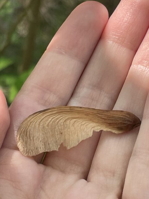
Maple samara, likely of either a red maple or silver maple, considering the environment.
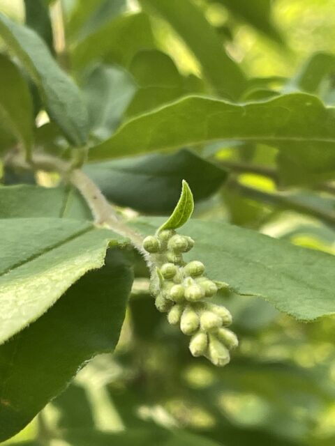
Spicebush drupes.
A You don’t have to be a botanist to see that some areas are higher in plant diversity and abundance than others. But everyone has a different perception of the quality of these sites. One way to reduce subjectivity when describing the quality of a site for plants is to use the Floristic Quality Assessment Index (FQAI). To assign an index number to a site, you first have to find the Coefficient of Conservatism (CC) for each plant species recorded from the site. The CC is a value of conservatism displayed by a species in relation to all other species in that region, on a scale from 0-10. Conservatism, in this case, is defined as the amount of specific requirements a species needs to thrive on a site. Think of it as the species being “conservative” with their choice of habitat. A score of 0 indicates a very wide range of ecological tolerances. A score of 10 indicates a very narrow range of ecological tolerances.
Cedar Bog is a very special site, because it has the highest FQAI score out of any site in Ohio! Many plants at this preserve don’t grow anywhere else in the state, and using FQAI terms, have high CC values. Let’s take a look at a few examples. These CC values are taken from the Floristic quality assessment index (FQAI) for vascular plants and mosses for the state of Ohio, by Andreas et al., 2004.
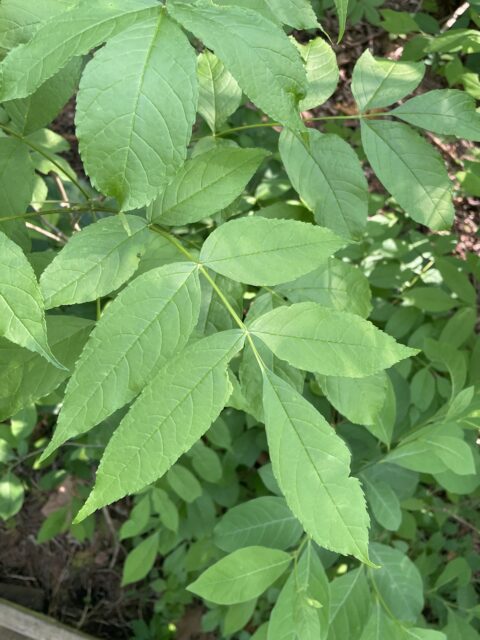
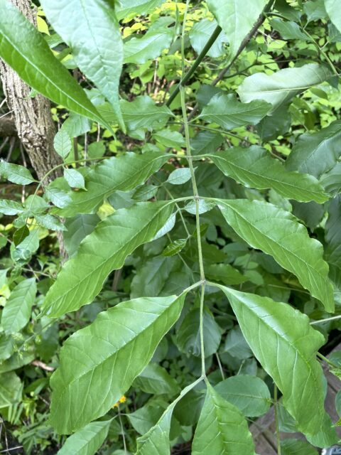
Black ash (Fraxinus nigra)
- CC=7
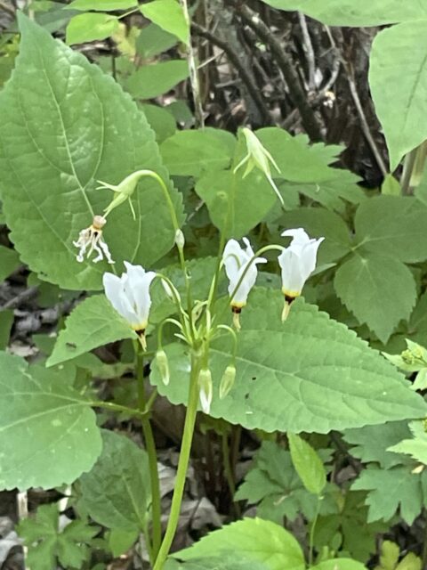
Shooting star (Dodecatheon meadia)
- CC=7
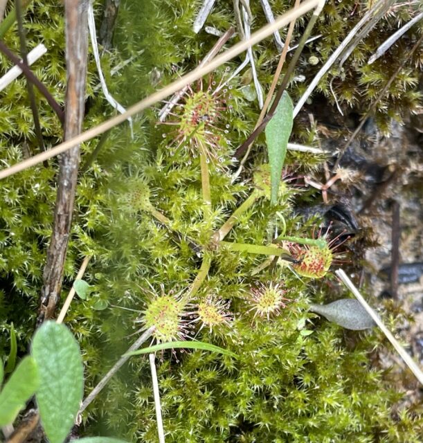
Round-leaved sundew (Drosera rotundifolia)
- CC=7
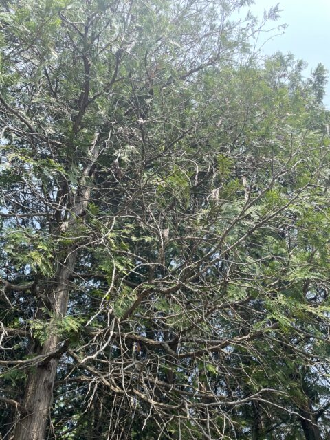
Northern white cedar (Thuja occidentalis)
- CC=9
A little side note: we encountered two species of ash at Cedar Bog, black ash and green ash (Fraxinus pennsylvanica). They can be physically differentiated by the presence of petioles attaching the leaflets to the central stalk. Green ash has petioles, but black ash leaflets are sessile, or lacking petioles.
Going back to the FQAI, let’s go through an example of how to calculate FQAI for two example sites.
Site 1: Swamp Forest
- Caltha palustris, Marsh marigold, wetland status: OBL, CC=6
- Iris virginica, Southern blue flag, wetland status: OBL, CC=6
- Lindera benzoin, Spicebush, wetland status: FACW-, CC=5
- Senecio aureus, Golden Ragwort, wetland status: FACW, CC=4
- Symplocarpus foetidus, Skunk-cabbage, wetland status: OBL, CC=6
- Ranunculus septentrionalis, Swamp buttercup, wetland status: FAC, CC=4
Site 2: Sedge Meadow
- Dasyphora fruticosa, Shrubby cinquefoil, wetland status: FACW, CC=10
- Drosera rotundifolia, Round-leaved sundew, wetland status: OBL, CC=7
- Betula pumila, Swamp birch, wetland status: OBL, CC=10
- Valeriana uliginosa, Swamp valerian, wetland status: (FACW+), CC=10
- Toxicodendron vernix, Poison sumac, wetland status: OBL, CC=7
- Utricularia minor, Lesser bladderwort, wetland status: OBL, CC=8
Using this equation, taken from the FQAI for Ohio by Andreas et al., we plug in the CC values and the number of native species for each site.
I=∑(CC)/√(Native)
Therefore, the FQAI for Site 1 is 12.65, and the FQAI for Site 2 is 21.22.